
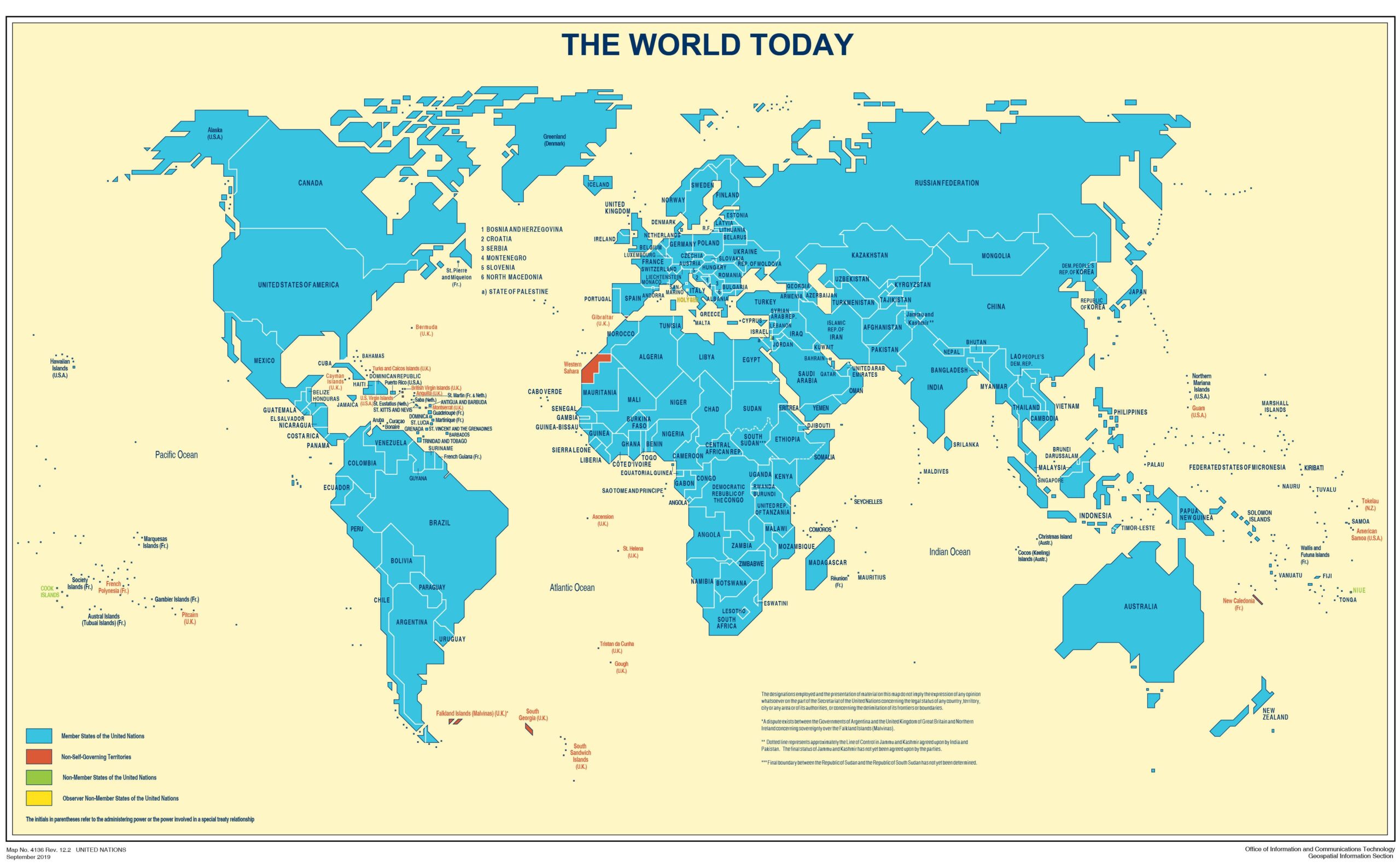
The United Nations has released its latest World Map for 2026, offering a fresh official cartographic reference of countries, territories and international boundaries across the globe.
Published by UN Geospatial on July 1, 2026, the updated map is now the latest version available through the United Nations’ official geospatial platform.
But for India, the map is particularly interesting because of the way it identifies areas where international boundaries or territorial claims remain unresolved.
What is new in the UN’s 2026 world map?
At first glance, the latest UN map may look like another political world map. But maps produced by the United Nations carry significance because they are used as an important geographic reference by governments, international organisations, researchers and the media.
The new edition, identified as Map No. 4651 Rev.4, is dated July 1, 2026. The UN provides the map in both PDF and high-resolution image formats.
The update also reflects the UN’s continuing work to maintain current geospatial information as countries, territories and geographic information evolve.
India and Jammu & Kashmir: An important detail
One of the most closely watched parts of any UN world map in India is its treatment of Jammu & Kashmir.
The UN’s map notes that a dotted line represents approximately the Line of Control in Jammu and Kashmir agreed upon by India and Pakistan, while also stating that the final status of Jammu and Kashmir has not been agreed upon by the parties.
This is an important distinction.
The map’s accompanying disclaimer makes clear that the boundaries, names and designations shown on the map do not imply official endorsement or acceptance by the United Nations.
In other words, a line appearing on a UN map should not automatically be interpreted as the UN taking a position on a territorial dispute.
Why UN maps matter
Modern maps are far more than geographic illustrations.
Geospatial information is increasingly being used for disaster management, infrastructure planning, humanitarian operations, environmental monitoring, security and development.
The UN itself describes geospatial information as an important foundation for modern decision-making. Its recent work highlights how geographic data can help governments understand where people, infrastructure, risks and inequalities are located.
The UN’s broader mapping programme also provides regularly updated geographic information covering countries around the world, including boundaries, roads, waterways and other geographic features.
Not every border on a map means the dispute is settled
This is perhaps the most important point for readers.
Political maps can make international borders appear simple and definitive. In reality, several boundaries and territorial claims around the world remain disputed.
The UN therefore includes explanatory notes and disclaimers on its maps.
For example, the map contains notes concerning Jammu & Kashmir and the India-Pakistan Line of Control. It also identifies other international territorial disputes, including the disagreement between Argentina and the United Kingdom concerning the Falkland Islands (Malvinas).
The result is a map that is not simply about drawing lines between countries. It also reflects the complexity of international geography and diplomacy.
The map is also a snapshot of a changing world
The latest UN world map is a reminder that the political geography of the world is not always as straightforward as the maps we grew up seeing in textbooks.
Countries have changing administrative arrangements, territories have different international statuses, and some borders remain subject to negotiation or dispute.
The United Nations maintains a large collection of geographic maps and services, including country, regional, thematic and operational maps.
The organisation’s latest world map therefore provides an updated snapshot of how the UN’s geospatial system represents the world in 2026.
Where can you see the new UN world map?
The complete 2026 United Nations World Map is available through the official UN Geospatial website in high-resolution JPEG and PDF formats.
Readers can view the map directly from the United Nations’ official Map of the World page.
The bigger picture
A world map may look like a simple picture of continents and countries, but every line can carry political, historical and diplomatic significance.
The UN’s latest map shows that geography and geopolitics remain closely connected and for India, the map’s treatment of Jammu & Kashmir makes the 2026 edition particularly worth examining.
Important Facts About the UN World Map
- UN World Map 2026 was published on July 1, 2026.
- It was prepared by the United Nations Geospatial team.
- The map shows countries, territories, oceans and major geographical features.
- The UN has been producing official maps since 1946.
- The map helps the world understand international geography and boundaries.
- Some borders shown on the map are disputed or not finally settled.
- The UN map is used by governments, researchers, schools and international organisations.
- Today, UN mapping also uses satellite images and digital technology for peacekeeping, disaster response and humanitarian work.